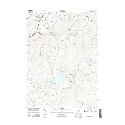
2015 Map of Spofford
USGS Topo · Published 2015About this map
The Connecticut River serves as the prominent western border of this region, separating the Windham County of Vermont from Cheshire County, New Hampshire. Historical infrastructure is evident near East Putney, where the East Putney Stone Arch Bridge spans the local drainage and multiple burial grounds such as East Putney Cem and Alpin Cem mark the early settlement patterns of the river valley. Moving inland, the landscape rises into a series of hills including Butterfield Hill and Hyland Hill, which define the drainage basins for numerous brooks flowing toward the river or south into the lakes.
Find a feature on this map
122 named features on this map. Tap any name to fly to it.
Don’t see what you’re looking for? This feature index may not catch every label — zoom into the map to look around manually.
Map Details
Editions of this 2015 Spofford Map
This is the sole edition of this map. No revisions or reprints were ever made.
Other maps of this area

1891 · Brattleboro
USGS Topo · 1:62,500

1893 · Brattleboro
USGS Topo · 1:62,500

1898 · Keene
USGS Topo · 1:62,500

1927 · Bellows Falls
USGS Topo · 1:48,000

1930 · Saxtons River
USGS Topo · 1:48,000

1930 · Bellows Falls
USGS Topo · 1:62,500

1932 · Brattleboro
USGS Topo · 1:48,000

1932 · Keene
USGS Topo · 1:62,500

1933 · Saxtons River
USGS Topo · 1:62,500
1935 · Brattleboro
USGS Topo · 1:62,500