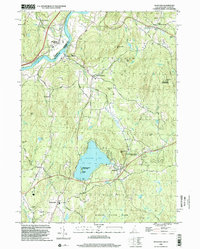
1998 Map of Spofford
USGS Topo · Published 2002About this map
Spofford Lake and the Connecticut River define the local topography of this New Hampshire and Vermont borderland. The landscape is characterized by a series of prominent peaks and protected woodlands, including Pisgah State Park and Hyland Hill State Forest. In the late 1990s, the area retains a mixture of rural village centers and preserved natural landmarks, such as Chesterfield Gorge State Park and the isolated Pierces Island State Park within the lake.
Find a feature on this map
67 named features on this map. Tap any name to fly to it.
Don’t see what you’re looking for? This feature index may not catch every label — zoom into the map to look around manually.
Map Details
Editions of this 1998 Spofford Map
This is the sole edition of this map. No revisions or reprints were ever made.
Other maps of this area

1891 · Brattleboro
USGS Topo · 1:62,500

1893 · Brattleboro
USGS Topo · 1:62,500

1898 · Keene
USGS Topo · 1:62,500

1927 · Bellows Falls
USGS Topo · 1:48,000

1930 · Saxtons River
USGS Topo · 1:48,000

1930 · Bellows Falls
USGS Topo · 1:62,500

1932 · Brattleboro
USGS Topo · 1:48,000

1932 · Keene
USGS Topo · 1:62,500

1933 · Saxtons River
USGS Topo · 1:62,500
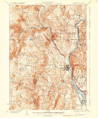
1935 · Brattleboro
USGS Topo · 1:62,500