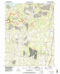
1994 Map of Spotsylvania
USGS Topo · Published 1997About this map
Fredericksburg-Spotsylvania National Military Park dominates the northwest corner of this quadrangle, preserving the hallowed ground of Civil War engagements near Spotsylvania. The landscape is a mix of agricultural heritage and late-20th-century residential expansion, particularly visible around the Ni River Reservoir. Local history is deeply rooted along the banks of the Po River and Ni River, where historical crossing points like Andrews Bridge and Sneels Bridge link the small communities of Snell, Old Trap, and Thornburg. The presence of a Confederate Cem near the courthouse area emphasizes the region's historical weight. Industry and infrastructure are marked by the remains of local milling operations, including Smiths Mill and Stannards Mill, while the eastern edge follows the modern corridor defined by Interchange 126 and Interchange 118.
Find a feature on this map
35 named features on this map. Tap any name to fly to it.
Don’t see what you’re looking for? This feature index may not catch every label — zoom into the map to look around manually.
Map Details
Editions of this 1994 Spotsylvania Map
This is the sole edition of this map. No revisions or reprints were ever made.
Other maps of this area

1887 · Spottsylvania
USGS Topo · 1:125,000

1889 · Fredericksburg
USGS Topo · 1:125,000

1892 · Fredericksburg
USGS Topo · 1:125,000

1892 · Spottsylvania
USGS Topo · 1:125,000

1894 · Fredericksburg
USGS Topo · 1:125,000

1926 · Stafford
USGS Topo · 1:62,500

1931 · Stafford
USGS Topo · 1:62,500

1942 · Woodford
USGS Topo · 1:31,680

1942 · Guinea
USGS Topo · 1:31,680

1942 · Ladysmith
USGS Topo · 1:31,680