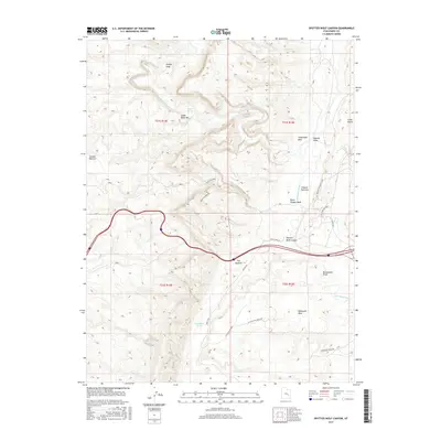
2017 Map of Spotted Wolf Canyon
USGS Topo · Published 2017About this map
Spotted Wolf Canyon serves as a primary corridor through the complex geological folds of Emery County, where modern infrastructure meets the primitive landscape of the San Rafael Swell. The San Rafael River carves deep into the stone at Lower Black Box, creating a dramatic transition toward the Tidwell Bottoms. Human footprints are concentrated along established routes like the Buckmaster Mines and the Ranch Byp, showing the area's continued use for resource extraction and ranching. Points of interest such as Camp Vinero and Swazys Leap offer specific landmarks for those navigating the high benches. South of the river, the landscape rises toward the broad Shadscale Mesa, punctuated by vital water sources like Moonshine Tanks and Sulphur Springs that have historically sustained movement through this arid region.
Find a feature on this map
28 named features on this map. Tap any name to fly to it.
Don’t see what you’re looking for? This feature index may not catch every label — zoom into the map to look around manually.
Map Details
Editions of this 2017 Spotted Wolf Canyon Map
This is the sole edition of this map. No revisions or reprints were ever made.
Other maps of this area

1885 · San Rafael
USGS Topo · 1:250,000

1886 · Price River
USGS Topo · 1:250,000

1896 · Price River
USGS Topo · 1:250,000

1953 · Red Plateau SE
USGS Topo · 1:24,000

1953 · Tidwell 2 SW
USGS Topo · 1:24,000

1953 · Beckwith Peak SW
USGS Topo · 1:24,000

1953 · Tidwell 2 NW
USGS Topo · 1:24,000

1954 · Stinking Spring Creek 1 SE
USGS Topo · 1:24,000

1954 · Stinking Spring Creek 1 NE
USGS Topo · 1:24,000

1954 · Tidwell 2 SE
USGS Topo · 1:24,000