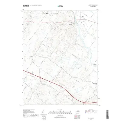
2019 Map of Spottsville
USGS Topo · Published 2019About this map
Green River meanders through the heart of this Henderson County landscape, defining the character of the riverine terrain between Spottsville and Bluff City. The map reveals a dense network of local routes, many reflecting historical land use and early settlement patterns, such as Hatchett Mill Rd and Alves Ferry Rd. These names hint at former riverside industries and vital water crossings that once connected these rural communities. The high-speed Audubon Parkway cuts a modern swath across the southern section, contrasting with the winding paths of Hickory Ridge RD and Zion RD. Small hubs like Zion, Baskett, and Hebbardsville serve as anchor points for the surrounding agricultural and wooded lands, while Race Cr and Lick Cr provide the primary drainage for the undulating uplands west of the main river valley.
Find a feature on this map
61 named features on this map. Tap any name to fly to it.
Don’t see what you’re looking for? This feature index may not catch every label — zoom into the map to look around manually.
Map Details
Editions of this 2019 Spottsville Map
This is the sole edition of this map. No revisions or reprints were ever made.
Other maps of this area

1905 · Newburg
USGS Topo · 1:62,500

1906 · Sebree
USGS Topo · 1:62,500

1908 · Calhoun
USGS Topo · 1:62,500

1914 · Henderson
USGS Topo · 1:48,000

1916 · Henderson
USGS Topo · 1:62,500

1949 · Robards
USGS Topo · 1:24,000

1951 · Robards
USGS Topo · 1:24,000

1951 · Yankeetown
USGS Topo · 1:24,000

1951 · Spottsville
USGS Topo · 1:24,000

1952 · Evansville
USGS Topo · 1:24,000