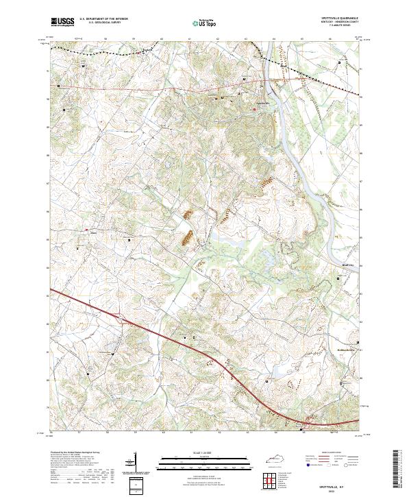
2022 Map of Spottsville
USGS Topo · Published 2022About this map
The Green River carves a winding path through this corner of Henderson County, Kentucky, defining the geography around Spottsville and Bluff City. This modern survey reveals a landscape where rural legacy and modern infrastructure coexist, from the concentrated village centers at Baskett and Zion to the intricate network of family roads like WH Negley Rd and Hatchett Mill Rd. The map is particularly dense with genealogical markers, noting numerous burial sites such as the Christodelphian Cem, Hicks Lewis Cem, and the Jordan Cem. Transport patterns remain centered on the river crossing at Spottsville, where Old US Hwy 60 and newer routes converge. Smaller drainage features like Race Cr and Double Dam Ditch further detail the low-lying terrain east of the Henderson city limits.
Find a feature on this map
84 named features on this map. Tap any name to fly to it.
Don’t see what you’re looking for? This feature index may not catch every label — zoom into the map to look around manually.
Map Details
Editions of this 2022 Spottsville Map
This is the sole edition of this map. No revisions or reprints were ever made.
Other maps of this area

1905 · Newburg
USGS Topo · 1:62,500

1906 · Sebree
USGS Topo · 1:62,500

1908 · Calhoun
USGS Topo · 1:62,500

1914 · Henderson
USGS Topo · 1:48,000

1916 · Henderson
USGS Topo · 1:62,500

1949 · Robards
USGS Topo · 1:24,000

1951 · Robards
USGS Topo · 1:24,000

1951 · Yankeetown
USGS Topo · 1:24,000

1951 · Spottsville
USGS Topo · 1:24,000

1952 · Evansville
USGS Topo · 1:24,000