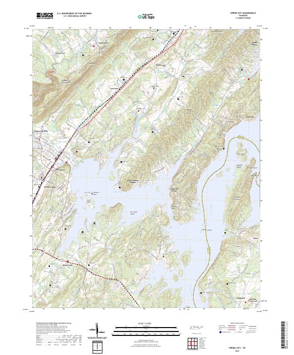
2022 Map of Spring City
USGS Topo · Published 2022About this map
Walden Ridge and the Cumberland Escarpment define the western horizon of this Tennessee landscape, where the terrain drops sharply toward the Piney River and the broad waters of Watts Bar Lake. The town of Spring City serves as a central hub, flanked by smaller communities like Lorraine and Wolf Creek. The geography is significantly shaped by the impoundment of the Tennessee River, which has created a complex shoreline of inlets and islands, including Duck Island and Doc Smith Island. Genealogists will find a high density of family and community burial sites across the ridges, such as the Jolley Cem, Cash Foust Cem, and the uniquely situated Cemetery Island. The map also details the transitional landscape from the high elevations of Gum Gap down to the lakeside settlements of Piney Shores Estates and Lakewood Village.
Find a feature on this map
200 named features on this map. Tap any name to fly to it.
Don’t see what you’re looking for? This feature index may not catch every label — zoom into the map to look around manually.
Map Details
Editions of this 2022 Spring City Map
This is the sole edition of this map. No revisions or reprints were ever made.
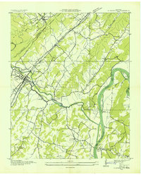
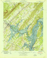
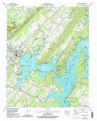
Historical Maps of Wolf Creek Through Time
4 maps found