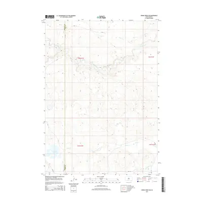
2015 Map of Spring Creek SW
USGS Topo · Published 2015About this map
The Little White River meanders across this high plains landscape on the border of Bennett and Todd Counties. This 2015 survey reveals a terrain defined by its water resources, where numerous small basins and intermittent streams punctuate the prairie. Features like North Cody Lake and Cody Lake in the southwestern corner, along with Jack Lake and Bob Lake to the east, suggest a landscape of prairie potholes and seasonal wetlands. The drainage network is complex, featuring the upper reaches of Spring Creek and Coffee Creek, while the presence of Minnechaduza Creek near Crane Rd indicates the proximity to the Niobrara River basin. This survey provides a clear view of the rural infrastructure in this part of South Dakota, showing the grid of section lines and local routes such as 296th St and Barnes Rd that connect the ranchlands of T36N and T35N.
Find a feature on this map
19 named features on this map. Tap any name to fly to it.
Don’t see what you’re looking for? This feature index may not catch every label — zoom into the map to look around manually.
Map Details
Editions of this 2015 Spring Creek SW Map
This is the sole edition of this map. No revisions or reprints were ever made.
Other maps of this area

1950 · Cody
USGS Topo · 1:62,500

1952 · Eli
USGS Topo · 1:62,500

1955 · Martin
USGS Topo · 1:250,000

1957 · Valentine
USGS Topo · 1:250,000

1958 · Martin
USGS Topo · 1:250,000

1959 · Valentine
USGS Topo · 1:250,000

1969 · Iron Shell Flat East
USGS Topo · 1:24,000

1969 · Spring Creek SW
USGS Topo · 1:24,000

1969 · Iron Shell Flat West
USGS Topo · 1:24,000

1969 · Spring Creek
USGS Topo · 1:24,000