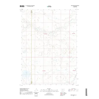
2017 Map of Spring Creek SW
USGS Topo · Published 2017About this map
The Little White River meanders across the northern portion of this map, carving a distinct valley through the Nebraska Sandhills transition zone along the South Dakota border. This 2017 survey documents a sparsely populated ranching landscape defined by its complex hydrology, where surface water is often ephemeral or collected in isolated basins. To the south, the terrain is dotted with several named bodies of water including Jack Lake, Sand Lake, and Bob Lake, which serve as critical landmarks in this open country. The boundary between Bennett and Todd Counties runs vertically through the western third of the sheet, marking a significant jurisdictional line in this rural region. Lower-tier local routes such as Barnes Rd and Mustang Meadows Rd provide limited access to the interior, while the headwaters of Minnechaduza Creek and Spring Creek drain the southern reaches toward the state line.
Find a feature on this map
16 named features on this map. Tap any name to fly to it.
Don’t see what you’re looking for? This feature index may not catch every label — zoom into the map to look around manually.
Map Details
Editions of this 2017 Spring Creek SW Map
This is the sole edition of this map. No revisions or reprints were ever made.
Other maps of this area

1950 · Cody
USGS Topo · 1:62,500

1952 · Eli
USGS Topo · 1:62,500

1955 · Martin
USGS Topo · 1:250,000

1957 · Valentine
USGS Topo · 1:250,000

1958 · Martin
USGS Topo · 1:250,000

1959 · Valentine
USGS Topo · 1:250,000

1969 · Iron Shell Flat East
USGS Topo · 1:24,000

1969 · Spring Creek SW
USGS Topo · 1:24,000

1969 · Iron Shell Flat West
USGS Topo · 1:24,000

1969 · Spring Creek
USGS Topo · 1:24,000