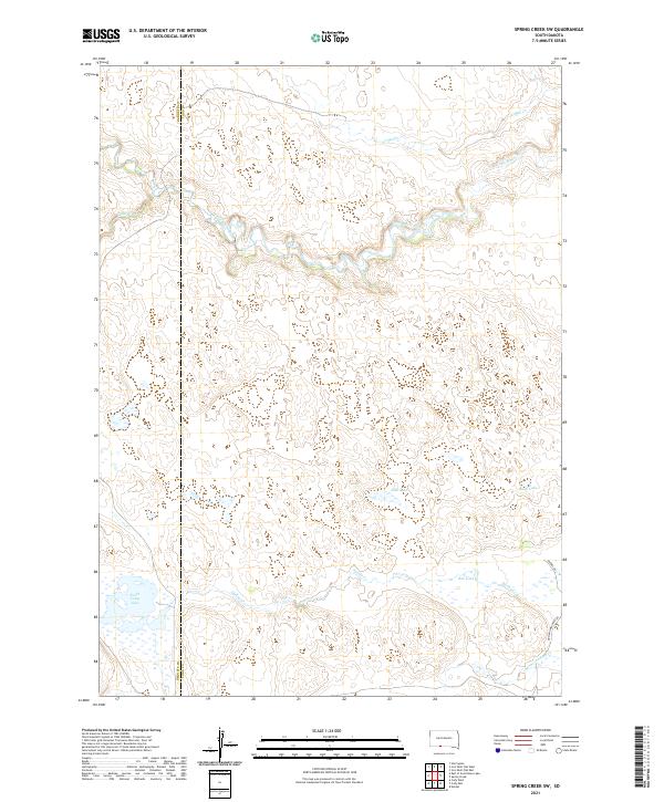
2021 Map of Spring Creek SW
USGS Topo · Published 2021About this map
The Little White River meanders across the northern reaches of this landscape, carving a distinct valley through the prairie of the Rosebud region. The hydrology of this area is remarkably intricate, defined by a series of significant water bodies including North Cody Lake, Jack Lake, and Bob Lake. These basins, along with Sand Lake, are characteristic of the upland wetlands found in this part of the state. The western boundary follows the line between Bennett and Todd counties, a division that separates these two rural jurisdictions. To the south, the headwaters of Minnechaduza Cr begin their descent toward the Niobrara system. Surface travel is limited to sparse corridors such as Barnes Rd and Mustang Meadows Rd, illustrating the low-density settlement pattern of this ranching and reservation country.
Find a feature on this map
16 named features on this map. Tap any name to fly to it.
Don’t see what you’re looking for? This feature index may not catch every label — zoom into the map to look around manually.
Map Details
Editions of this 2021 Spring Creek SW Map
This is the sole edition of this map. No revisions or reprints were ever made.
Other maps of this area

1950 · Cody
USGS Topo · 1:62,500

1952 · Eli
USGS Topo · 1:62,500

1955 · Martin
USGS Topo · 1:250,000

1957 · Valentine
USGS Topo · 1:250,000

1958 · Martin
USGS Topo · 1:250,000

1959 · Valentine
USGS Topo · 1:250,000

1969 · Iron Shell Flat East
USGS Topo · 1:24,000

1969 · Spring Creek SW
USGS Topo · 1:24,000

1969 · Iron Shell Flat West
USGS Topo · 1:24,000

1969 · Spring Creek
USGS Topo · 1:24,000