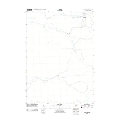
2012 Map of Spring Creek
USGS Topo · Published 2012About this map
The Little White River meanders across the northern plains of Todd County, defining a landscape where ranching and local heritage intersect. In the community of Spring Creek, the proximity of BIA Road 5 and BIA 30 Rd facilitates travel across the open terrain, while Sawmill Canyon provides a distinct geographical break to the northeast. Genealogy and local history are anchored by several remote burial sites, including Saint Angelo Cem, Saint Patrick Cem, and the more distant Gurue Cem located further west along the banks of Spring Creek. Further south, the map details the headwaters of Minnechaduza Creek, illustrating the drainage patterns that have shaped this portion of South Dakota for generations. The presence of the Arnold Ranch underscores the enduring agricultural character of the region, marking a specific point of settlement within this vast expanse of prairie and creek beds.
Find a feature on this map
12 named features on this map. Tap any name to fly to it.
Don’t see what you’re looking for? This feature index may not catch every label — zoom into the map to look around manually.
Map Details
Editions of this 2012 Spring Creek Map
This is the sole edition of this map. No revisions or reprints were ever made.
Other maps of this area

1950 · Kilgore
USGS Topo · 1:62,500

1950 · Cody
USGS Topo · 1:62,500

1955 · Martin
USGS Topo · 1:250,000

1957 · Valentine
USGS Topo · 1:250,000

1958 · Martin
USGS Topo · 1:250,000

1959 · Valentine
USGS Topo · 1:250,000

1969 · Iron Shell Flat East
USGS Topo · 1:24,000

1969 · Spring Creek SW
USGS Topo · 1:24,000

1969 · Iron Shell Flat West
USGS Topo · 1:24,000

1969 · Spring Creek
USGS Topo · 1:24,000