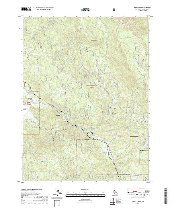
2021 Map of Spring Garden
USGS Topo · Published 2021About this map
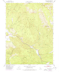
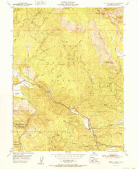
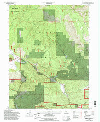
Plumas National Forest dominates this mountain landscape, where the settlements of Spring Garden and Massack sit along the winding corridors of the upper Sierra Nevada. The terrain is defined by dramatic elevation changes, rising from the American Valley to the heights of Grizzly Ridge and Taylor Rock. Watercourses like Squirrel Creek and Greenhorn Cr. carve through deep ravines, including the prominent Empire Ravine, reflecting the complex hydrology of the Feather River watershed.
Find a feature on this map
49 named features on this map. Tap any name to fly to it.
Don’t see what you’re looking for? This feature index may not catch every label — zoom into the map to look around manually.
Map Details
Editions of this 2021 Spring Garden Map
This is the sole edition of this map. No revisions or reprints were ever made.
Historical Maps of Massack Through Time
4 maps found