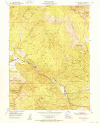
1952 Map of Spring Garden
USGS Topo · Published 1952About this map
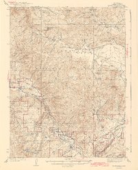
The Western Pacific railroad carves a winding path through this high-altitude landscape of the northern Sierra Nevada, following the contours of Greenhorn Creek and Estray Creek. At the base of Grizzly Ridge, the small settlement of Spring Garden serves as a vital point along the rail line, complete with a water tank for steam-era operations. Further northwest along the tracks lies Massack, where a Sawmill points to the timber industry that sustained these mountain communities during the early 1950s.
Find a feature on this map
37 named features on this map. Tap any name to fly to it.
Don’t see what you’re looking for? This feature index may not catch every label — zoom into the map to look around manually.
Map Details
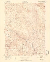
Editions of this 1952 Spring Garden Map
2 editions found
Other maps of this area

1886 · Honey Lake
USGS Topo · 1:250,000

1891 · Downieville
USGS Topo · 1:125,000

1891 · Honey Lake
USGS Topo · 1:250,000

1893 · Honey Lake
USGS Topo · 1:250,000

1893 · Downieville
USGS Topo · 1:125,000

1895 · Downieville
USGS Topo · 1:125,000

1896 · Downieville
USGS Topo · 1:125,000
1897 · Downieville
USGS Topo · 1:125,000
1937 · Blairsden
USGS Topo · 1:48,000
1943 · Blairsden
USGS Topo · 1:62,500