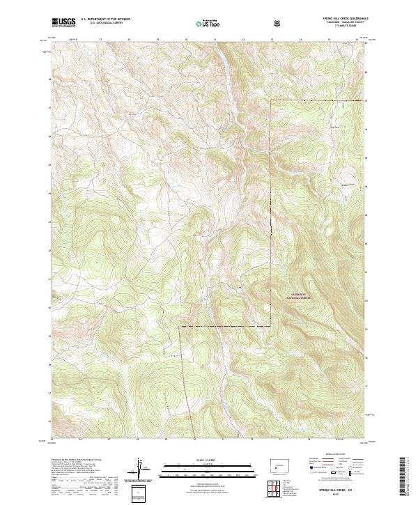
2022 Map of Spring Hill Creek
USGS Topo · Published 2022About this map
Gunnison National Forest land defines this Saguache County terrain, where high-altitude drainages converge within the northern reaches of the San Luis Valley region. A complex network of watercourses, including Spring Hill Creek, S Beaver Creek, and Deer-Beaver Creek, reveals a landscape shaped by seasonal runoff and remote springs such as Right Spring. The topography is marked by significant elevation changes, from the prominent Black Ridge in the south to open clearings like Long Park and Soldiers Park in the northeast. Access to this isolated interior is facilitated by primitive routes like Co RD 1tt and Co RD 6uu, which follow the natural contours of the land near Watts Draw. This 2022 survey provides an essential view of the watershed and land management boundaries during the early 21st century.
Find a feature on this map
24 named features on this map. Tap any name to fly to it.
Don’t see what you’re looking for? This feature index may not catch every label — zoom into the map to look around manually.
Map Details
Editions of this 2022 Spring Hill Creek Map
This is the sole edition of this map. No revisions or reprints were ever made.
Other maps of this area

1908 · Uncompahgre
USGS Topo · 1:125,000

1911 · Uncompahgre
USGS Topo · 1:125,000

1954 · Iris NW
USGS Topo · 1:24,000

1954 · Iola
USGS Topo · 1:24,000

1956 · Montrose
USGS Topo · 1:250,000

1959 · Montrose
USGS Topo · 1:250,000

1960 · Montrose
USGS Topo · 1:250,000

1962 · Rudolph Hill
USGS Topo · 1:24,000

1962 · Iris
USGS Topo · 1:24,000

1962 · Powderhorn
USGS Topo · 1:24,000