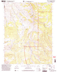
2001 Map of Spring Hill Creek
USGS Topo · Published 2004About this map
The Gunnison National Forest high country, straddling the Gunnison and Saguache county line, is defined by a landscape of high ridges and narrow draws shaped by decades of mining and ranching. The presence of the Continental Mine and Midland Mine alongside numerous labeled prospects highlights the era’s mineral exploration, while the remote Shelton Ranch, Cooper Ranch, and Mergelmann Cow Camp suggest a persistent livestock economy in this difficult terrain.
Find a feature on this map
35 named features on this map. Tap any name to fly to it.
Don’t see what you’re looking for? This feature index may not catch every label — zoom into the map to look around manually.
Map Details
Editions of this 2001 Spring Hill Creek Map
This is the sole edition of this map. No revisions or reprints were ever made.
Other maps of this area

1908 · Uncompahgre
USGS Topo · 1:125,000

1911 · Uncompahgre
USGS Topo · 1:125,000

1954 · Iris NW
USGS Topo · 1:24,000

1954 · Iola
USGS Topo · 1:24,000

1956 · Montrose
USGS Topo · 1:250,000

1959 · Montrose
USGS Topo · 1:250,000

1960 · Montrose
USGS Topo · 1:250,000

1962 · Rudolph Hill
USGS Topo · 1:24,000

1962 · Iris
USGS Topo · 1:24,000

1962 · Powderhorn
USGS Topo · 1:24,000