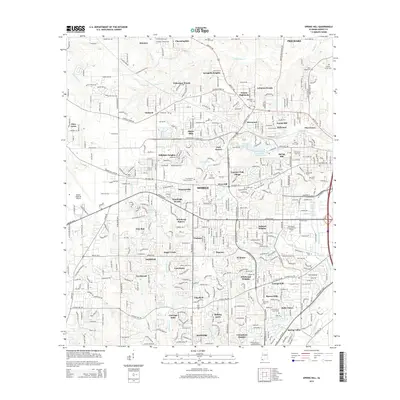
2014 Map of Spring Hill
USGS Topo · Published 2014About this map
The Univ of S Alabama and Spring Hill Coll campuses anchor this western portion of Mobile, showing a landscape defined by institutional growth and suburban development. The terrain is crisscrossed by several vital waterways, including Threemile Cr and Twelvemile Cr, which flow through various residential enclaves like Huntleigh Woods and Jackson Heights. To the northwest, the edge of Prichard meets established neighborhoods such as Forest Highlands and Acropolis Heights.
Find a feature on this map
87 named features on this map. Tap any name to fly to it.
Don’t see what you’re looking for? This feature index may not catch every label — zoom into the map to look around manually.
Map Details
Editions of this 2014 Spring Hill Map
This is the sole edition of this map. No revisions or reprints were ever made.
Other maps of this area

1922 · Mobile
USGS Topo · 1:62,500

1940 · Hollingers Island
USGS Topo · 1:31,680

1940 · Mobile
USGS Topo · 1:31,680

1940 · Mobile
USGS Topo · 1:62,500

1941 · Chickasaw
USGS Topo · 1:31,680

1941 · Hurley
USGS Topo · 1:62,500

1941 · Creola
USGS Topo · 1:62,500

1942 · Kushla
USGS Topo · 1:31,680

1942 · Theodore
USGS Topo · 1:31,680

1942 · Wilmer
USGS Topo · 1:62,500