
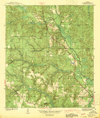
1942 Map of Kushla
USGS Topo · Published 1942About this map
Chickasaw Creek and its complex network of tributaries define this 1940 survey of Mobile County. The landscape is marked by small upland settlements and rural congregations, including Smithtown, Mauvilla, and the namesake village of Kushla. The Gulf Mobile and Ohio railroad corridor provides the primary structural axis for the region, running roughly parallel to Bayou Sara and passing through the heart of the developed areas.
Find a feature on this map
25 named features on this map. Tap any name to fly to it.
Don’t see what you’re looking for? This feature index may not catch every label — zoom into the map to look around manually.
Map Details
Editions of this 1942 Kushla Map
2 editions found
Other maps of this area

1922 · Mobile
USGS Topo · 1:62,500

1940 · Mobile
USGS Topo · 1:31,680

1940 · Mobile
USGS Topo · 1:62,500

1941 · Chickasaw
USGS Topo · 1:31,680

1941 · Hurley
USGS Topo · 1:62,500

1941 · Creola
USGS Topo · 1:62,500

1942 · Wilmer
USGS Topo · 1:62,500

1943 · Creola
USGS Topo · 1:62,500

1943 · Chickasaw
USGS Topo · 1:31,680
1943 · Mobile
USGS Topo · 1:31,680