
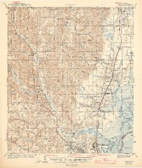
1943 Map of Creola
USGS Topo · Published 1943About this map
Chickasaw Creek and its many tributaries, such as Silver Creek and Beaver Pond Creek, dominate the central drainage of this Gulf Coast hinterland during the early 1940s. The landscape is a complex network of wetlands and small settlements, where the Gulf Mobile and Ohio Railroad and the Southern Railway provide critical transit corridors parallel to the Mobile Road. To the south, the industrial influence of the coast becomes evident near Whistler and North Mobile, including a dedicated Shipyard and a Golf Course. Local life is anchored by small rural schools like Kushla Sch and Starlight Sch, along with several community burial grounds including Mauvilla Cem and the Baldwin Cem. The northern portion of the map shows the rugged interior, marked by the Fire Tower and the Saint Stephens Base Line, illustrating the transition from swampy bayous to the higher ground of Sand Hill.
Find a feature on this map
95 named features on this map. Tap any name to fly to it.
Don’t see what you’re looking for? This feature index may not catch every label — zoom into the map to look around manually.
Map Details
Editions of this 1943 Creola Map
2 editions found
Other maps of this area

1921 · Fairhope
USGS Topo · 1:62,500

1922 · Mobile
USGS Topo · 1:62,500

1940 · Mobile
USGS Topo · 1:31,680

1940 · Mobile
USGS Topo · 1:62,500

1941 · Chickasaw
USGS Topo · 1:31,680

1941 · Blakeley
USGS Topo · 1:31,680

1941 · Hurley
USGS Topo · 1:62,500

1941 · Bay Minette
USGS Topo · 1:62,500

1941 · Creola
USGS Topo · 1:62,500

1941 · Fairhope
USGS Topo · 1:62,500