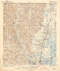
1943 Map of Creola
USGS Topo · Published 1943About this map
The Mobile River and its intricate network of bayous and islands dominate the eastern edge of this 1943 quadrangle, revealing the industrial and maritime character of Mobile County during the early war years. Heavy rail corridors including the Gulf Mobile and Ohio RR and Southern Ry converge near Chickasaw, where the Shipyard and Golf Course indicate a rapidly developing suburban and industrial fringe. To the west, the landscape transitions into upland drainage basins like Chickasaw Creek and Bayou Sara, where rural life is anchored by family-named landmarks and local institutions.
Find a feature on this map
100 named features on this map. Tap any name to fly to it.
Don’t see what you’re looking for? This feature index may not catch every label — zoom into the map to look around manually.
Map Details
Editions of this 1943 Creola Map
2 editions found

Other maps of this area

1921 · Fairhope
USGS Topo · 1:62,500

1922 · Mobile
USGS Topo · 1:62,500

1940 · Mobile
USGS Topo · 1:31,680

1940 · Mobile
USGS Topo · 1:62,500

1941 · Chickasaw
USGS Topo · 1:31,680

1941 · Blakeley
USGS Topo · 1:31,680

1941 · Hurley
USGS Topo · 1:62,500

1941 · Bay Minette
USGS Topo · 1:62,500

1941 · Creola
USGS Topo · 1:62,500

1941 · Fairhope
USGS Topo · 1:62,500