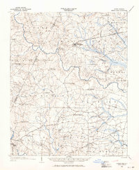
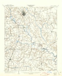
1902 Map of Spring Hope
USGS Topo · Published 1965About this map
The Tar River winds its way through the center of this rural North Carolina landscape, serving as a primary geographical anchor for the surrounding communities at the dawn of the twentieth century. The town of Spring Hope is the most developed hub on the sheet, positioned along the Atlantic Coast Line R. R. and the Springhope Branch. This transportation corridor stands in contrast to the numerous unincorporated settlements like Gold Valley Crossroads, Frazier Crossroads, and Lamm Crossroads, which illustrate a pattern of development dictated by local road junctions and river crossings.
Find a feature on this map
58 named features on this map. Tap any name to fly to it.
Don’t see what you’re looking for? This feature index may not catch every label — zoom into the map to look around manually.
Map Details
Editions of this 1902 Spring Hope Map
This is the sole edition of this map. No revisions or reprints were ever made.
Other maps of this area
1902 · Kenly
USGS Topo · 1:62,500

1902 · Rocky Mount
USGS Topo · 1:62,500
1903 · Kenly
USGS Topo · 1:62,500

1904 · Rocky Mount
USGS Topo · 1:62,500
1904 · Springhope
USGS Topo · 1:62,500
1904 · Wilson
USGS Topo · 1:62,500

1953 · Norfolk
USGS Topo · 1:250,000

1953 · Rocky Mount
USGS Topo · 1:250,000

1953 · Raleigh
USGS Topo · 1:250,000

1953 · Greensboro
USGS Topo · 1:250,000