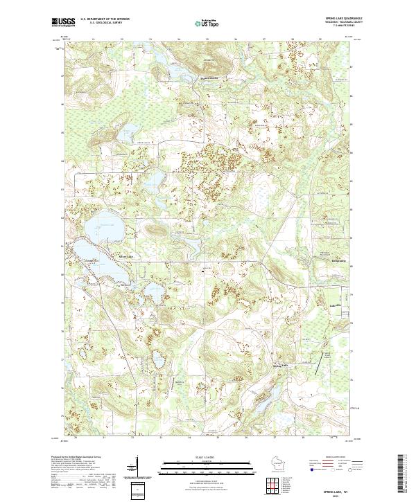
2022 Map of Spring Lake
USGS Topo · Published 2022About this map
Mount Morris and the surrounding central Wisconsin wetlands define this portion of Waushara County, where a dense network of glacial lakes and creeks has long shaped local settlement and recreation. Large water bodies like Irogami Lake and Silver Lake are central features, punctuated by landmarks such as Chicago Point and Fox Tail Point Bay. The map reveals the intricate residential development around these shorelines, contrasting with the expansive Wautoma Swamp and the forested tracts of the Wood Tick Strip.
Find a feature on this map
83 named features on this map. Tap any name to fly to it.
Don’t see what you’re looking for? This feature index may not catch every label — zoom into the map to look around manually.
Map Details
Editions of this 2022 Spring Lake Map
This is the sole edition of this map. No revisions or reprints were ever made.
Other maps of this area

1915 · Neshkoro
USGS Topo · 1:48,000

1918 · Neshkoro
USGS Topo · 1:62,500

1955 · Green Bay
USGS Topo · 1:250,000

1957 · Madison
USGS Topo · 1:250,000

1959 · Wautoma
USGS Topo · 1:48,000

1960 · Madison
USGS Topo · 1:250,000

1961 · Redgranite
USGS Topo · 1:62,500

1961 · Montello
USGS Topo · 1:62,500

1961 · Saxeville
USGS Topo · 1:24,000

1961 · Wild Rose
USGS Topo · 1:24,000