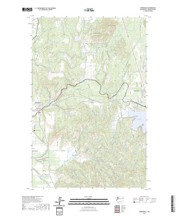
2023 Map of Springdale
USGS Topo · Published 2023About this map
Springdale and the eastern shores of Loon Lake anchor this Stevens County landscape, where the terrain shifts from the elevations of Jumpoff Joe Mtn and Limekiln Hill down to the drainage of Sheep Creek. The presence of a Lime Kiln near the central heights and the Springdale Cem south of the main settlement reflect the local industry and community roots of the region. Transportation and water management are evident through features like Pine Bluff Airport and Sowers Reservoir, alongside a network of rural routes including Old Springdale Hwy and Welliver Mountain Rd. The eastern portion of the map focuses on the residential and recreational development near Tracy Point and Silver Point, while southern clearings like Ahren Meadows show the area's agricultural character.
Find a feature on this map
63 named features on this map. Tap any name to fly to it.
Don’t see what you’re looking for? This feature index may not catch every label — zoom into the map to look around manually.
Map Details
Editions of this 2023 Springdale Map
This is the sole edition of this map. No revisions or reprints were ever made.
Other maps of this area

1927 · Chewelah
USGS Topo · 1:125,000

1930 · Chewelah
USGS Topo · 1:125,000

1944 · Clayton
USGS Topo · 1:62,500

1944 · Wellpinit
USGS Topo · 1:62,500

1950 · Clayton
USGS Topo · 1:62,500

1953 · Wellpinit
USGS Topo · 1:62,500

1955 · Spokane
USGS Topo · 1:250,000

1958 · Spokane
USGS Topo · 1:250,000

1958 · Sandpoint
USGS Topo · 1:250,000

1963 · Sandpoint
USGS Topo · 1:250,000