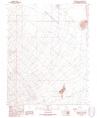
1986 Map of Springdale SW
USGS Topo · Published 1986About this map
Death Valley National Monument reaches into the southwestern corner of this Nye County landscape, where the high desert terrain transitions into the wide expanse of Sarcobatus Flat. The desert floor is marked by a prominent Depression and scattered topographic high points, reflecting the arid character of the northern Amargosa region during the mid-1980s. A significant historical corridor is preserved in the form of an Old Railroad Grade running through the northeastern sector, tracing a path that once supported the area’s industrial or transit needs. Evidence of land use is sparse, though a single Corral provides a localized reference point for ranching activity in this expansive basin. The map is defined by its meticulous contouring of the alluvial fans and drainage patterns that characterize the transition from mountainous terrain to the flat valley floor.
Find a feature on this map
9 named features on this map. Tap any name to fly to it.
Don’t see what you’re looking for? This feature index may not catch every label — zoom into the map to look around manually.
Map Details
Editions of this 1986 Springdale SW Map
This is the sole edition of this map. No revisions or reprints were ever made.
Other maps of this area

1908 · Kawich
USGS Topo · 1:250,000

1908 · Lida
USGS Topo · 1:250,000

1908 · Furnace Creek
USGS Topo · 1:250,000

1908 · Ballarat
USGS Topo · 1:250,000

1910 · Furnace Creek
USGS Topo · 1:250,000

1913 · Lida
USGS Topo · 1:250,000

1913 · Ballarat
USGS Topo · 1:250,000

1942 · Tolicha Peak
USGS Topo · 1:125,000

1942 · Bullfrog
USGS Topo · 1:125,000

1948 · Death Valley
USGS Topo · 1:250,000