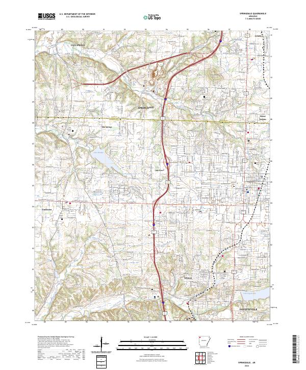
2024 Map of Springdale
USGS Topo · Published 2024About this map
Springdale serves as the central hub of this modern survey, which captures the dense interconnection of communities across the Benton and Washington County line. The map illustrates a landscape where established towns like Tontitown, Johnson, and Cave Springs are linked by an intricate network of local roads and suburban expansion. Water features such as Spring Creek and Brush Creek thread through these developed areas, while larger bodies like Lake Elmdale and Lake Fayetteville provide significant local landmarks.
Find a feature on this map
156 named features on this map. Tap any name to fly to it.
Don’t see what you’re looking for? This feature index may not catch every label — zoom into the map to look around manually.
Map Details
Editions of this 2024 Springdale Map
This is the sole edition of this map. No revisions or reprints were ever made.
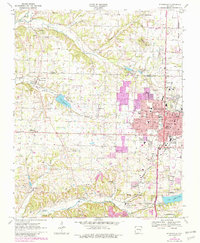
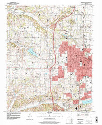
Historical Maps of Oak Grove Through Time
3 maps found