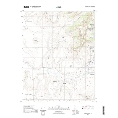
2020 Map of Springdale West
USGS Topo · Published 2020About this map
Grafton sits along the southern bank of the Virgin River, representing a notable point of interest for researchers of southwestern Utah's riverfront settlements. This survey shows the area's transition from the flat agricultural lands of Rockville Bench to the sheer verticality of Zion National Park. Significant cultural landmarks include the Grafton Cem and Rockville Cem, which offer genealogical value for local families. The landscape is defined by massive sandstone structures such as The West Temple and The Sundial, while the Virgin Wild And Scenic River designation highlights the protected status of the waterway. Transportation in this era is characterized by a mix of modern paved routes like Zion Park Blvd and traditional tracks such as the Dalton Wash Trail and Coalpits Wash Trail, reflecting the dual nature of the region as both a residence for locals in Springdale and a gateway for wilderness exploration.
Find a feature on this map
51 named features on this map. Tap any name to fly to it.
Don’t see what you’re looking for? This feature index may not catch every label — zoom into the map to look around manually.
Map Details
Editions of this 2020 Springdale West Map
This is the sole edition of this map. No revisions or reprints were ever made.
Other maps of this area

1885 · St. George
USGS Topo · 1:250,000

1886 · Kanab
USGS Topo · 1:250,000

1891 · St. George
USGS Topo · 1:250,000

1953 · Cedar City
USGS Topo · 1:250,000

1954 · La Verkin 4 SE
USGS Topo · 1:24,000

1954 · La Verkin 4 NW
USGS Topo · 1:24,000

1954 · La Verkin 4 SW
USGS Topo · 1:24,000

1954 · La Verkin 1 SW
USGS Topo · 1:24,000
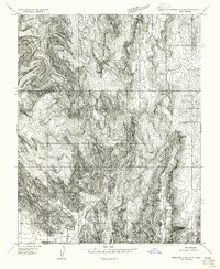
1956 · Springdale SW
USGS Topo · 1:24,000

1958 · Cedar City
USGS Topo · 1:250,000