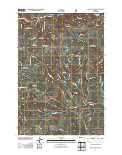
2011 Map of Springer Mountain
USGS Topo · Published 2011About this map
Springer Mountain and the surrounding heights of Yamhill County dominate this 2011 survey, a landscape defined by an intricate network of drainage and forestry access roads. The northern reach is shaped by the Nestucca River and Testament Creek, while the southern terrain falls toward Tindle Creek and Cosper Creek. This era of the landscape is marked by modern forest management and recreational landmarks, including the Coast Creek Shelter and the Camp Cooper Reservoir tucked in the northeast corner.
Find a feature on this map
46 named features on this map. Tap any name to fly to it.
Don’t see what you’re looking for? This feature index may not catch every label — zoom into the map to look around manually.
Map Details
Editions of this 2011 Springer Mountain Map
This is the sole edition of this map. No revisions or reprints were ever made.
Other maps of this area

1942 · Ginger Peak
USGS Topo · 1:62,500

1942 · Sheridan
USGS Topo · 1:62,500

1942 · Spirit Mtn
USGS Topo · 1:62,500

1942 · Fairdale
USGS Topo · 1:62,500

1948 · Vancouver
USGS Topo · 1:250,000

1950 · Vancouver
USGS Topo · 1:250,000

1950 · Vancouver
USGS Topo · 1:250,000

1955 · Blaine
USGS Topo · 1:62,500

1955 · Fairdale
USGS Topo · 1:62,500

1955 · Grand Ronde
USGS Topo · 1:62,500