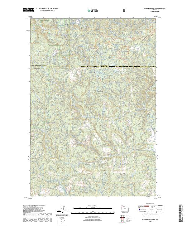
2023 Map of Springer Mountain
USGS Topo · Published 2023About this map
The Nestucca Wild and Scenic River corridor defines the northern reaches of this landscape, carving through the dense timberlands of the Siuslaw National Forest. This section of the Coast Range at the border of Tillamook and Yamhill counties is characterized by a complex network of high ridges and deep drainages, with Springer Mtn and Bell Mountain serving as dominant landmarks. The area's water system is intricate, featuring headwaters and tributaries such as Bible Creek, Testament Creek, and the southern flowing Willamina Creek. In the northeast corner, the Camp Cooper Reservoir marks a rare point of water impoundment. The terrain is crisscrossed by forest development roads like Nat For Dev Rd 14, illustrating the ongoing management of these highlands. Notable peaks like Pumpkinseed Mtn and Darling Mtn rise above the many creek valleys, including Burton Creek and Cosper Creek.
Find a feature on this map
47 named features on this map. Tap any name to fly to it.
Don’t see what you’re looking for? This feature index may not catch every label — zoom into the map to look around manually.
Map Details
Editions of this 2023 Springer Mountain Map
This is the sole edition of this map. No revisions or reprints were ever made.
Other maps of this area

1942 · Ginger Peak
USGS Topo · 1:62,500

1942 · Sheridan
USGS Topo · 1:62,500

1942 · Spirit Mtn
USGS Topo · 1:62,500

1942 · Fairdale
USGS Topo · 1:62,500

1948 · Vancouver
USGS Topo · 1:250,000

1950 · Vancouver
USGS Topo · 1:250,000

1950 · Vancouver
USGS Topo · 1:250,000

1955 · Blaine
USGS Topo · 1:62,500

1955 · Fairdale
USGS Topo · 1:62,500

1955 · Grand Ronde
USGS Topo · 1:62,500