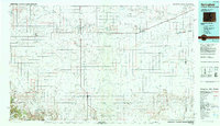
1984 Map of Springfield
USGS Topo · Published 1984About this map
Springfield serves as the central hub for this high-plains landscape where Colorado, Kansas, and Oklahoma converge. The era is defined by a grid of agricultural section lines and the vital corridor of the Atchison Topeka and Santa Fe railroad, which links the small grain-handling communities of Pritchett, Vilas, and Walsh. In the southern reaches, the terrain descends into a more complex network of drainage basins, including the Cimarron River and its North Fork, as well as the deep incisions of Picture Canyon and Gallinas Canyon. These canyons provide a sharp contrast to the level prairie found near Stonington and Campo. Local landmarks like Black Butte and the State Fishing Area stand out against the vast network of ephemeral draws and creeks, such as Bear Creek and Horse Creek, that once dictated the movement of cattle and early homesteaders across Baca County.
Find a feature on this map
48 named features on this map. Tap any name to fly to it.
Don’t see what you’re looking for? This feature index may not catch every label — zoom into the map to look around manually.
Map Details
Editions of this 1984 Springfield Map
This is the sole edition of this map. No revisions or reprints were ever made.
Other maps of this area

1891 · Albany
USGS Topo · 1:125,000

1891 · Higbee
USGS Topo · 1:125,000

1891 · Springfield
USGS Topo · 1:125,000

1892 · Vilas
USGS Topo · 1:125,000

1892 · Two Butte
USGS Topo · 1:125,000

1892 · Mt Carrizo
USGS Topo · 1:125,000

1893 · Higbee
USGS Topo · 1:125,000

1893 · Two Butte
USGS Topo · 1:125,000

1893 · Springfield
USGS Topo · 1:125,000

1893 · Albany
USGS Topo · 1:125,000