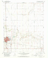
1978 Map of Springfield East
USGS Topo · Published 1979About this map
The town of Springfield serves as the focal point for this late-1970s landscape in Baca County, where the High Plains terrain is broken by the winding courses of Bear Creek and Wild Horse Canyon. The presence of the Atchison Topeka and Santa Fe railroad line running through the southern half of the quadrangle highlights the enduring importance of rail transport to this agricultural region. Evidence of mid-century community life is visible on the town's periphery, including a Golf Course, a Drive-in Theater, and the Springfield Airport to the northwest.
Find a feature on this map
17 named features on this map. Tap any name to fly to it.
Don’t see what you’re looking for? This feature index may not catch every label — zoom into the map to look around manually.
Map Details
Editions of this 1978 Springfield East Map
This is the sole edition of this map. No revisions or reprints were ever made.
Other maps of this area

1891 · Albany
USGS Topo · 1:125,000

1891 · Springfield
USGS Topo · 1:125,000

1892 · Vilas
USGS Topo · 1:125,000

1892 · Two Butte
USGS Topo · 1:125,000

1893 · Two Butte
USGS Topo · 1:125,000

1893 · Springfield
USGS Topo · 1:125,000

1893 · Albany
USGS Topo · 1:125,000

1955 · La Junta
USGS Topo · 1:250,000

1958 · La Junta
USGS Topo · 1:250,000

1968 · La Junta
USGS Topo · 1:250,000