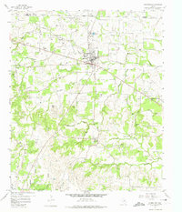
1958 Map of Springtown
USGS Topo · Published 1974About this map
Springtown and the surrounding Parker County countryside are defined by a mix of early Texas settlement history and mid-century industrial development. The Springtown Oil Field dominates the northwest, evidenced by numerous wells, a Pumping Sta, and a Gas Plant. To the south, the community of Veal Station is marked by a Historical Monument, signaling its local significance alongside other small established centers like Goshen and Carter.
Find a feature on this map
35 named features on this map. Tap any name to fly to it.
Don’t see what you’re looking for? This feature index may not catch every label — zoom into the map to look around manually.
Map Details
Editions of this 1958 Springtown Map
4 editions found

Other maps of this area

1891 · Weatherford
USGS Topo · 1:125,000

1893 · Weatherford
USGS Topo · 1:125,000

1924 · Sunset 4-d
USGS Topo · 1:48,000

1930 · Boyd
USGS Topo · 1:62,500

1932 · Springtown
USGS Topo · 1:62,500

1954 · Dallas
USGS Topo · 1:250,000

1954 · Sherman
USGS Topo · 1:250,000

1955 · Azle
USGS Topo · 1:24,000
1955 · Springtown SE
USGS Topo · 1:24,000

1958 · Dallas
USGS Topo · 1:250,000