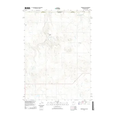
2014 Map of Springview NW
USGS Topo · Published 2014About this map
The Keya Paha River winds through this borderland where South Dakota meets Nebraska, carving a valley across the northern reaches of Keya Paha County. This landscape is defined by the erosion of several major tributaries, including Jimmie Cr, Holt Cr, and Jordan Cr, which create a complex network of draws and ridges. Local water management is evident through a series of named catchments such as Bloomstrom Reservoir and Kappleman Reservoir. The cattle-country character of the region is reflected in its sparse road network, including Ne-12 and 304th St, and the preservation of pioneer history at sites like Kenaston Cem and Jordan Cem. A crossing at Dubel Bridge serves as a critical point of connectivity across the river, while the topographic relief is most pronounced near Deckers Gulch.
Find a feature on this map
17 named features on this map. Tap any name to fly to it.
Don’t see what you’re looking for? This feature index may not catch every label — zoom into the map to look around manually.
Map Details
Editions of this 2014 Springview NW Map
This is the sole edition of this map. No revisions or reprints were ever made.
Other maps of this area

1950 · Meadville
USGS Topo · 1:24,000

1955 · Mitchell
USGS Topo · 1:250,000

1955 · O'Neill
USGS Topo · 1:250,000

1959 · O'Neill
USGS Topo · 1:250,000

1959 · Mitchell
USGS Topo · 1:250,000

1964 · Dallas SW
USGS Topo · 1:24,000
1964 · Springview
USGS Topo · 1:24,000

1964 · Paxton
USGS Topo · 1:24,000
1964 · Burton
USGS Topo · 1:24,000
1964 · Springview SE
USGS Topo · 1:24,000