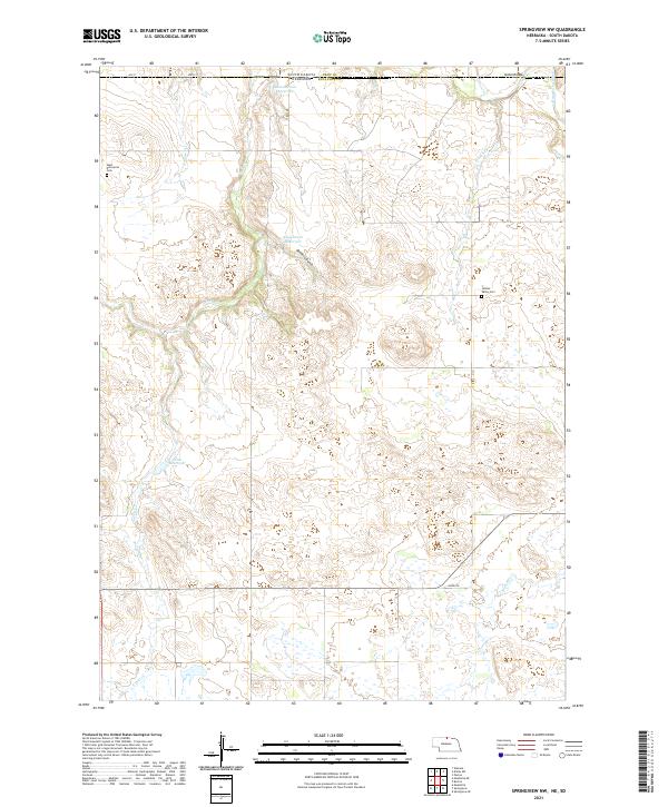
2021 Map of Springview NW
USGS Topo · Published 2021About this map
West Enterprise Cem and Jordan Valley Cem sit amidst the sectioned ranchlands of Keya Paha County in this contemporary record of north-central Nebraska. The landscape is defined by the drainage systems of the Keya Paha Riv and its tributaries, including Holt Cr and Jordan Cr. This high-plains terrain is marked by essential water management features such as Bloomstrom Reservoir, Kappleman Reservoir, and Sloan Reservoir, which support the agricultural life of the region. The map tracks the interstate boundary between South Dakota and Nebraska, where the Dubel Bridge crosses the river. This survey captures a rural environment where infrastructure is focused on utility, from the rugged descent of Deckers Gulch to the straight-line grid of local routes like 304th St and Trail Rd.
Find a feature on this map
25 named features on this map. Tap any name to fly to it.
Don’t see what you’re looking for? This feature index may not catch every label — zoom into the map to look around manually.
Map Details
Editions of this 2021 Springview NW Map
This is the sole edition of this map. No revisions or reprints were ever made.
Other maps of this area

1950 · Meadville
USGS Topo · 1:24,000

1955 · Mitchell
USGS Topo · 1:250,000

1955 · O'Neill
USGS Topo · 1:250,000

1959 · O'Neill
USGS Topo · 1:250,000

1959 · Mitchell
USGS Topo · 1:250,000

1964 · Dallas SW
USGS Topo · 1:24,000
1964 · Springview
USGS Topo · 1:24,000

1964 · Paxton
USGS Topo · 1:24,000
1964 · Burton
USGS Topo · 1:24,000
1964 · Springview SE
USGS Topo · 1:24,000