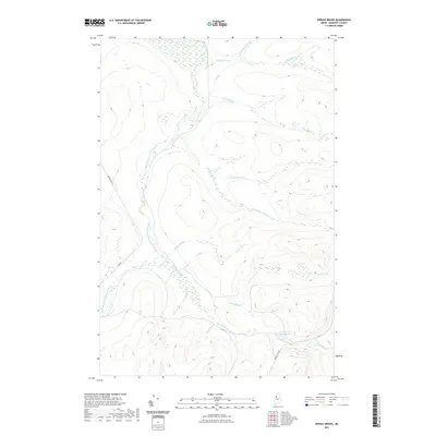
2021 Map of Spruce Brook
USGS Topo · Published 2021About this map
The Baker Branch Saint John River winds through the northwestern corner of Somerset County, defining a landscape of dense water networks in this part of Maine. This 2021 survey illustrates a remote timberland environment where logging roads like Baker Lake Rd and Russell Mt Rd provide the primary access to the interior. The drainage pattern is complex, with numerous tributaries such as Higgins Brook, Trout Brook, and Campbell Brook feeding into the larger river system. To the southeast, the Loon Stream Deadwater and Loon Stream indicate a slower-moving, wetland-heavy hydrology characteristic of the North Maine Woods. These labels and the lack of permanent settlements reflect the region's long-standing status as a managed forest and watershed.
Find a feature on this map
18 named features on this map. Tap any name to fly to it.
Don’t see what you’re looking for? This feature index may not catch every label — zoom into the map to look around manually.
Map Details
Editions of this 2021 Spruce Brook Map
This is the sole edition of this map. No revisions or reprints were ever made.
Other maps of this area

1954 · Baker Lake
USGS Topo · 1:62,500

1954 · Caucomgomoc Lake
USGS Topo · 1:62,500

1954 · Allagash Lake
USGS Topo · 1:62,500

1954 · St. John Pond
USGS Topo · 1:62,500

1954 · Presque Isle
USGS Topo · 1:250,000

1958 · Presque Isle
USGS Topo · 1:250,000

1958 · Caucomgomoc Lake
USGS Topo · 1:62,500

1958 · Saint John Pond
USGS Topo · 1:62,500

1960 · Presque Isle
USGS Topo · 1:250,000

1961 · Allagash Lake
USGS Topo · 1:62,500