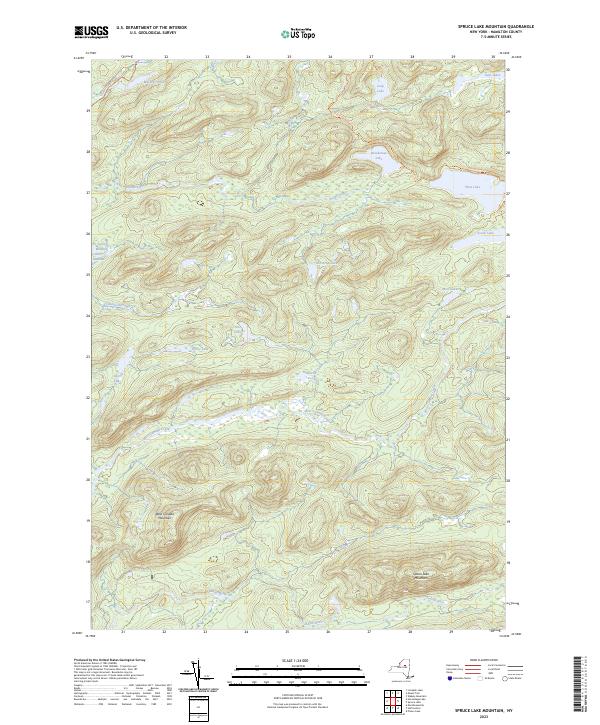
2023 Map of Spruce Lake Mountain
USGS Topo · Published 2023About this map
Spruce Lake Mountain and West Canada Mountain dominate this high-elevation Adirondack landscape in Hamilton County. The drainage patterns here are defined by the winding course of the Indian River and the headwaters of West Canada Creek, which carves through the southwestern portion of the map. This area remains largely defined by its primitive character, with a network of footpaths like the Brooktrout Lake Trl and West Lake Trl providing the only terrestrial access to remote water bodies including Deep Lake, Brooktrout Lake, and the aptly named Carter Mudhole. The distribution of these glacial lakes, from the large West Lake to the clusters of Mica Lakes and Twin Lakes, indicates a landscape shaped by persistent water and complex topography, largely untouched by permanent road infrastructure.
Find a feature on this map
22 named features on this map. Tap any name to fly to it.
Don’t see what you’re looking for? This feature index may not catch every label — zoom into the map to look around manually.
Map Details
Editions of this 2023 Spruce Lake Mountain Map
This is the sole edition of this map. No revisions or reprints were ever made.
Other maps of this area

1900 · Canada Lake
USGS Topo · 1:62,500

1900 · Wilmurt
USGS Topo · 1:62,500

1901 · Old Forge
USGS Topo · 1:62,500

1902 · Wilmurt
USGS Topo · 1:62,500

1903 · West Canada Lakes
USGS Topo · 1:62,500

1904 · Piseco Lake
USGS Topo · 1:62,500

1906 · Piseco Lake
USGS Topo · 1:62,500

1908 · Piseco Lake
USGS Topo · 1:62,500

1950 · Utica
USGS Topo · 1:250,000
1954 · Ohio
USGS Topo · 1:62,500