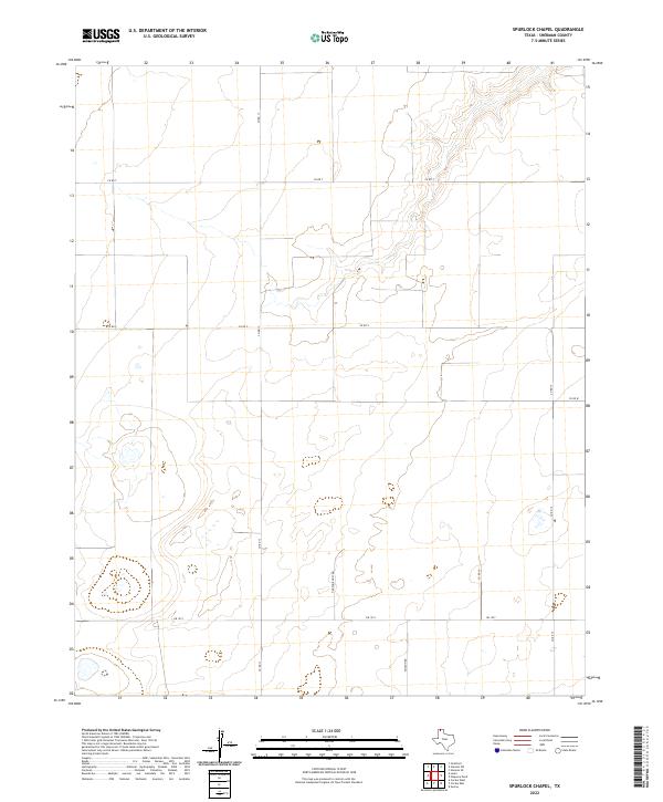
2022 Map of Spurlock Chapel
USGS Topo · Published 2022About this map
Sherman County agricultural lands and cattle ranching corridors define this high plains landscape as it appeared in 2022. The area is intersected by a network of county roads and Fm 1573, which provides the primary east-west passage across the southern portion of the quadrangle. Significant for family history research and local land use studies, the map documents a system of rural infrastructure including Hudson Rd and the distinctive Hudson Boost Rd. Topographic variations and scattered wetlands punctuate the terrain, illustrating the water management patterns essential for regional ranching. The grid-like arrangement of roads such as Co Rd 13 and Co Rd 17 highlights the systematic division of Texas Panhandle acreage into productive agricultural tracts.
Find a feature on this map
9 named features on this map. Tap any name to fly to it.
Don’t see what you’re looking for? This feature index may not catch every label — zoom into the map to look around manually.
Map Details
Editions of this 2022 Spurlock Chapel Map
This is the sole edition of this map. No revisions or reprints were ever made.
Other maps of this area

1954 · Perryton
USGS Topo · 1:250,000

1954 · Dalhart
USGS Topo · 1:250,000

1958 · Perryton
USGS Topo · 1:250,000

1958 · Dalhart
USGS Topo · 1:250,000

1962 · Dalhart
USGS Topo · 1:250,000

1963 · Cactus East
USGS Topo · 1:24,000

1964 · Stevens SW
USGS Topo · 1:24,000

1964 · Stratford
USGS Topo · 1:24,000

1965 · Lautz
USGS Topo · 1:24,000
1965 · Cactus West
USGS Topo · 1:24,000