
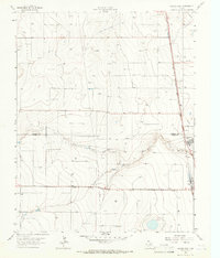
1965 Map of Spurlock Chapel
USGS Topo · Published 1966About this map
The northern High Plains landscape of Sherman County is defined by a series of Pipelines and service structures that highlight the mid-century energy infrastructure of the Texas Panhandle. Grounded by the presence of Spurlock Chapel, the area exhibits a mix of sparse settlement and industrial utility. A prominent Pumping Sta and scattered gas wells across the terrain indicate the regional focus on natural resource extraction during the 1960s.
Find a feature on this map
7 named features on this map. Tap any name to fly to it.
Don’t see what you’re looking for? This feature index may not catch every label — zoom into the map to look around manually.
Map Details
Editions of this 1965 Spurlock Chapel Map
This is the sole edition of this map. No revisions or reprints were ever made.
Other maps of this area

1954 · Perryton
USGS Topo · 1:250,000

1954 · Dalhart
USGS Topo · 1:250,000

1958 · Perryton
USGS Topo · 1:250,000

1958 · Dalhart
USGS Topo · 1:250,000

1962 · Dalhart
USGS Topo · 1:250,000

1963 · Cactus East
USGS Topo · 1:24,000

1964 · Stevens SW
USGS Topo · 1:24,000

1964 · Stratford
USGS Topo · 1:24,000

1965 · Lautz
USGS Topo · 1:24,000
1965 · Cactus West
USGS Topo · 1:24,000