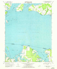
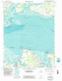
1968 Map of St Clements Island
USGS Topo · Published 1972About this map
St Clements Island stands as a prominent landmark in the Potomac River at the intersection of Maryland and Virginia waters, marked here with a Stone Cross and navigational lights. This late 1960s survey captures the maritime geography of the Northern Neck and Southern Maryland before extensive modern development. The landscape is defined by deep inlets and named necks, including Newtown Neck and Machodoc Neck, where the coastal economy is visible through clusters of Gravel Pits and localized infrastructure like the Landing Strip near Coles Point.
Find a feature on this map
72 named features on this map. Tap any name to fly to it.
Don’t see what you’re looking for? This feature index may not catch every label — zoom into the map to look around manually.
Map Details
Editions of this 1968 St Clements Island Map
5 editions found
Other maps of this area

1892 · Leonardtown
USGS Topo · 1:62,500

1892 · Piney Point
USGS Topo · 1:62,500

1892 · Montross
USGS Topo · 1:62,500

1894 · Wicomico
USGS Topo · 1:62,500

1894 · Piney Point
USGS Topo · 1:62,500

1895 · Wicomico
USGS Topo · 1:62,500

1895 · Leonardtown
USGS Topo · 1:62,500

1895 · Nomini
USGS Topo · 1:125,000

1895 · Piney Point
USGS Topo · 1:62,500

1895 · Montross
USGS Topo · 1:62,500