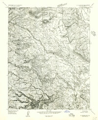
1956 Map of St. George SW
USGS Topo · Published 1956About this map
The Virgin River and Santa Clara River converge in this mid-1950s survey of the high desert along the Utah-Arizona border. The settlement of Atkinsville sits near the Atkinsville Wash, while the northern portion of the map is dominated by the Shivwits Indian Reservation. Significant hydraulic engineering is evident through the Santa Clara Canal and St. George Canal, which parallel the riverbanks to support agriculture in this arid landscape. The terrain is defined by dramatic elevation changes, moving from the First Narrows of the Virgin River to prominent overlooks like Shivwits Point and West Mountain. Notable cattle or ranching landmarks such as Blakes Laming Ground and the distinct depressions of Big Round Valley and Little Round Valley provide insight into the land use of Washington County during this era.
Find a feature on this map
31 named features on this map. Tap any name to fly to it.
Don’t see what you’re looking for? This feature index may not catch every label — zoom into the map to look around manually.
Map Details
Editions of this 1956 St. George SW Map
This is the sole edition of this map. No revisions or reprints were ever made.
Other maps of this area

1885 · St. George
USGS Topo · 1:250,000

1886 · Mt. Trumbull
USGS Topo · 1:250,000

1891 · St. George
USGS Topo · 1:250,000

1892 · Mt. Trumbull
USGS Topo · 1:250,000

1953 · Cedar City
USGS Topo · 1:250,000

1953 · Grand Canyon
USGS Topo · 1:250,000

1954 · Beaver Dam Mts NE
USGS Topo · 1:24,000

1954 · Wolf Hole Mtn. NW
USGS Topo · 1:24,000

1954 · Beaver Dam Mts SE
USGS Topo · 1:24,000

1954 · Wolf Hole Mtn. NE
USGS Topo · 1:24,000