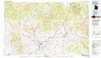
1980 Map of St. George
USGS Topo · Published 1987About this map
St George and its neighboring communities are positioned at the convergence of the Santa Clara River and the Virgin River during a period of significant regional coordination in the early 1980s. The landscape is defined by dramatic geologic shifts, from the towering Hurricane Cliffs to the red rock canyons of Snow Canyon State Park. This 1980 survey reveals the infrastructure of southwest Utah just as the area was maturing, showing established settlements like Santa Clara, Washington, and Hurricane alongside the vast tracts of Zion National Park and Dixie National Forest. The map documents the vital water management systems of the high desert, including the Quail Creek Reservoir and Gunlock Reservoir. Local industry and commerce are marked by features like the Apex Mine and the St George Municipal Airport, while small settlements such as Veyo and New Harmony provide a detailed look at the rural character of Washington County before modern expansion transformed the valley.
Find a feature on this map
157 named features on this map. Tap any name to fly to it.
Don’t see what you’re looking for? This feature index may not catch every label — zoom into the map to look around manually.
Map Details
Editions of this 1980 St. George Map
2 editions found
Other maps of this area

1885 · St. George
USGS Topo · 1:250,000

1885 · Pioche
USGS Topo · 1:250,000

1886 · Kanab
USGS Topo · 1:250,000

1886 · Saint Thomas
USGS Topo · 1:250,000

1886 · Mt. Trumbull
USGS Topo · 1:250,000

1886 · Pioche
USGS Topo · 1:250,000

1886 · Kaibab
USGS Topo · 1:250,000

1891 · St. George
USGS Topo · 1:250,000

1892 · Mt. Trumbull
USGS Topo · 1:250,000

1893 · Saint Thomas
USGS Topo · 1:250,000