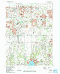
1992 Map of St. John
USGS Topo · Published 1992About this map
Schererville and St John are central to this 1990s topographic study of Lake County, Indiana, showcasing the suburban expansion and land-use patterns of the Calumet region. The map captures a transitional landscape where residential developments like Rolling Hill Estates and Lincoln Village sit alongside older features like the Conrail rail line and established institutions such as Hyles-Anderson College.
Find a feature on this map
65 named features on this map. Tap any name to fly to it.
Don’t see what you’re looking for? This feature index may not catch every label — zoom into the map to look around manually.
Map Details
Editions of this 1992 St. John Map
This is the sole edition of this map. No revisions or reprints were ever made.
Other maps of this area

1892 · Calumet
USGS Topo · 1:62,500

1893 · Calumet
USGS Topo · 1:62,500

1900 · Toleston
USGS Topo · 1:62,500

1900 · Calumet
USGS Topo · 1:62,500

1901 · Calumet
USGS Topo · 1:62,500

1929 · Calumet City
USGS Topo · 1:24,000

1929 · Dyer
USGS Topo · 1:24,000

1930 · Dyer
USGS Topo · 1:24,000

1949 · Crete
USGS Topo · 1:62,500

1953 · Leroy
USGS Topo · 1:24,000
Featured Places
- Merrillville, Ross Township
- Schererville, IN
- Crown Point, Center Township
- Griffith, North Township
- Cedar Lake, IN