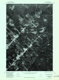
1977 Map of St. Omer
USGS Topo · Published 1983About this map
St Omer and the surrounding borderlands of the Quebec-Maine boundary are captured here through rectified photoimagery from 1977. This orthophotoquad reveals a landscape defined by industrial forest management, where the geometric patterns of timber harvesting contrast with the dense natural canopy. The solitary settlement of St Omer sits along a primary corridor, serving as a point of human activity in an otherwise vast expanse of managed woodland. Unlike traditional line-and-symbol maps, this aerial perspective allows for a direct study of the terrain, showing the exact footprint of roads and clearings as they existed in the late 1970s. It is a revealing record of the North Woods at a time when remote logging operations and boundary settlements were the primary drivers of land use in this international border region.
Find a feature on this map
1 named feature on this map. Tap any name to fly to it.
Don’t see what you’re looking for? This feature index may not catch every label — zoom into the map to look around manually.
Map Details
Editions of this 1977 St. Omer Map
This is the sole edition of this map. No revisions or reprints were ever made.
Other maps of this area

1954 · Presque Isle
USGS Topo · 1:250,000

1955 · Little East Lake
USGS Topo · 1:62,500

1955 · Depot Lake
USGS Topo · 1:62,500

1955 · Seven Islands
USGS Topo · 1:62,500

1958 · Presque Isle
USGS Topo · 1:250,000

1960 · Presque Isle
USGS Topo · 1:250,000

1962 · Edmundston
USGS Topo · 1:250,000

1976 · East Lake
USGS Topo · 1:24,000

1976 · East Lake SE
USGS Topo · 1:24,000
1976 · St. Pamphile
USGS Topo · 1:24,000