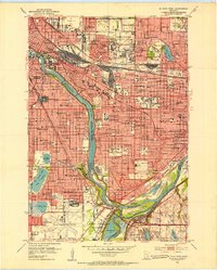
1951 Map of St. Paul West
USGS Topo · Published 1953About this map
The Mississippi River and Minnesota River converge at the historic Fort Snelling Reservation, serving as the geographical anchor for this mid-century survey of the Twin Cities. The urban landscape of Minneapolis and St Paul is shown in a period of significant post-war expansion, characterized by dense residential blocks, numerous parochial schools like St Cecilia Sch, and sprawling institutional grounds. Notable landmarks include the State Fairgrounds, the University of Minnesota, and the industrial activity near Wold-Chamberlain Airport. The map also captures the recreational and natural spaces of the era, from the shores of Lake Nokomis and Lake Hiawatha to the wooded areas around Minnehaha Falls. For genealogists, the map provides precise locations for several major burial grounds, including Roselawn Cemetery, Calvary Cemetery, and the Fort Snelling National Cemetery.
Find a feature on this map
161 named features on this map. Tap any name to fly to it.
Don’t see what you’re looking for? This feature index may not catch every label — zoom into the map to look around manually.
Map Details
Editions of this 1951 St. Paul West Map
2 editions found
Other maps of this area

1896 · Minneapolis
USGS Topo · 1:62,500

1896 · St. Paul
USGS Topo · 1:62,500

1901 · Minneapolis
USGS Topo · 1:62,500

1902 · White Bear
USGS Topo · 1:62,500

1902 · Anoka
USGS Topo · 1:62,500

1951 · St. Paul West
USGS Topo · 1:24,000

1951 · Inver Grove
USGS Topo · 1:24,000

1951 · St. Paul SW
USGS Topo · 1:24,000

1951 · St. Paul East
USGS Topo · 1:24,000

1951 · St. Paul
USGS Topo · 1:62,500