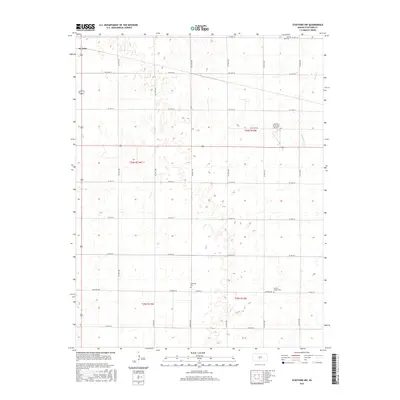
2015 Map of Stafford NW
USGS Topo · Published 2015About this map
Leesburg Cem and Prairie Chapel Cem sit among the section-line roads of central Kansas, marking the locations of earlier community focal points in Stafford County. This landscape is defined by the rigid Jeffersonian grid of the Public Land Survey System, with roads like Leesburg Rd and E Old Hwy 50 following the boundaries of t24s r12w and t24s r13w. The presence of the Stafford Municipal Airport highlights the mid-century infrastructure supporting the nearby agricultural centers. While much of the terrain is dedicated to large-scale farming, natural drainage is still evident along the winding courses of Peace Cr and Dooleyville Cr in the eastern portions of the quadrangle. For genealogists, the inclusion of Verning Cem near the northern border provides a specific point of reference for families settled in the area between St. John and Stafford.
Find a feature on this map
20 named features on this map. Tap any name to fly to it.
Don’t see what you’re looking for? This feature index may not catch every label — zoom into the map to look around manually.
Map Details
Editions of this 2015 Stafford NW Map
This is the sole edition of this map. No revisions or reprints were ever made.
Other maps of this area

1891 · Great Bend
USGS Topo · 1:125,000

1892 · Pratt
USGS Topo · 1:125,000

1893 · Great Bend
USGS Topo · 1:125,000

1894 · Pratt
USGS Topo · 1:125,000

1955 · Great Bend
USGS Topo · 1:250,000

1955 · Pratt
USGS Topo · 1:250,000

1957 · Great Bend
USGS Topo · 1:250,000

1958 · Great Bend
USGS Topo · 1:250,000

1959 · Pratt
USGS Topo · 1:250,000
1971 · Hudson SE
USGS Topo · 1:24,000