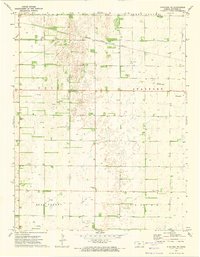
1972 Map of Stafford NW
USGS Topo · Published 1974About this map
The Atchison Topeka and Santa Fe railroad cuts a diagonal path across this central Kansas landscape, dividing the agricultural plains of Stafford and West Cooper townships. The map documents a rural economy driven by petroleum extraction, with numerous wells and an extensive Oil Field concentrated in the northern and western sections. Settlement is sparse, defined by essential community anchors like Prairie Chapel and several local burying grounds including Verning Cem, Leesburg Cem, and Prairie Chapel Cem.
Find a feature on this map
16 named features on this map. Tap any name to fly to it.
Don’t see what you’re looking for? This feature index may not catch every label — zoom into the map to look around manually.
Map Details
Editions of this 1972 Stafford NW Map
This is the sole edition of this map. No revisions or reprints were ever made.
Other maps of this area

1891 · Great Bend
USGS Topo · 1:125,000

1892 · Pratt
USGS Topo · 1:125,000

1893 · Great Bend
USGS Topo · 1:125,000

1894 · Pratt
USGS Topo · 1:125,000

1955 · Great Bend
USGS Topo · 1:250,000

1955 · Pratt
USGS Topo · 1:250,000

1957 · Great Bend
USGS Topo · 1:250,000

1958 · Great Bend
USGS Topo · 1:250,000

1959 · Pratt
USGS Topo · 1:250,000
1971 · Hudson SE
USGS Topo · 1:24,000