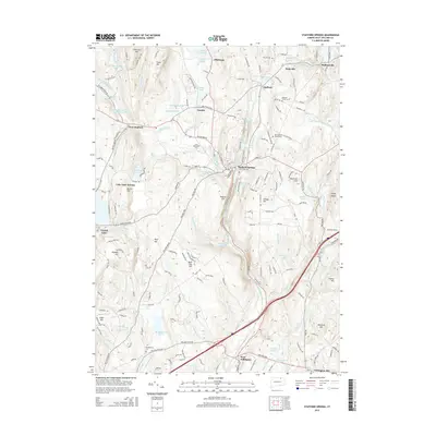
2015 Map of Stafford Springs
USGS Topo · Published 2015About this map
The Willimantic River carves a deep valley through this Tolland County landscape, shaping the development of Stafford Springs and surrounding settlements. Historically known for its mineral springs, the area shows a distinct transition from the industrial and commercial centers near the river to the upland agricultural hills. Several small villages, including Hydeville and Staffordville in the northeast, are linked by a network of local roads and the prominent Tolland TPKE. The topography is defined by significant elevations like Chestnut Hill and Diamond Ledge in the north, contrasting with the wetlands of Skungamaug Marsh to the south.
Find a feature on this map
210 named features on this map. Tap any name to fly to it.
Don’t see what you’re looking for? This feature index may not catch every label — zoom into the map to look around manually.
Map Details
Editions of this 2015 Stafford Springs Map
This is the sole edition of this map. No revisions or reprints were ever made.
Other maps of this area

1887 · Brookfield
USGS Topo · 1:62,500

1887 · Palmer
USGS Topo · 1:62,500

1889 · Palmer
USGS Topo · 1:62,500

1890 · Brookfield
USGS Topo · 1:62,500

1892 · Woodstock
USGS Topo · 1:62,500

1892 · Tolland
USGS Topo · 1:62,500

1893 · Palmer
USGS Topo · 1:62,500

1893 · Brookfield
USGS Topo · 1:62,500

1908 · Ware
USGS Topo · 1:125,000

1915 · Brookfield
USGS Topo · 1:62,500