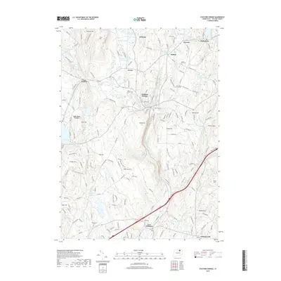
2018 Map of Stafford Springs
USGS Topo · Published 2018About this map
Stafford Springs and the surrounding Tolland County highlands are defined by a network of small mill-town settlements and significant water resources. The terrain is structured by prominent rises such as Chestnut Hill, Neff Hill, and Buff Cap Hill, which overlook a landscape deeply carved by the Middle River and the Skungamaug River. This 2018 survey reveals a preservation of historical burial sites, including the Old Stafford Street Cem and Saint Edward Cem, alongside established residential pockets like Staffordville and Hydeville. The southern portion of the map transition into the rural character of West Willington and Willington Hill. Large bodies of water like Crystal Lake and Ellithorpe Reservoir serve as central landmarks, anchoring the local topography between the various brooks and ponds that historically powered the region's industry.
Find a feature on this map
192 named features on this map. Tap any name to fly to it.
Don’t see what you’re looking for? This feature index may not catch every label — zoom into the map to look around manually.
Map Details
Editions of this 2018 Stafford Springs Map
This is the sole edition of this map. No revisions or reprints were ever made.
Other maps of this area

1887 · Brookfield
USGS Topo · 1:62,500

1887 · Palmer
USGS Topo · 1:62,500

1889 · Palmer
USGS Topo · 1:62,500

1890 · Brookfield
USGS Topo · 1:62,500

1892 · Woodstock
USGS Topo · 1:62,500

1892 · Tolland
USGS Topo · 1:62,500

1893 · Palmer
USGS Topo · 1:62,500

1893 · Brookfield
USGS Topo · 1:62,500

1908 · Ware
USGS Topo · 1:125,000

1915 · Brookfield
USGS Topo · 1:62,500