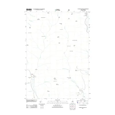
2012 Map of Stairs Mountain
USGS Topo · Published 2012About this map
Crawford Notch and the southern reaches of the Presidential Range define this high-altitude landscape. The map details a network of backcountry infrastructure essential for travelers in this part of the White Mountains, including the Mizpah Spring Hut and several remote outposts like Isolation Shelter and Resolution Shelter. These locations serve as critical navigation points along the rugged ridgelines of Montalban Ridge and Rocky Branch Ridge. Along the eastern edge, the corridor following the Ellis River and Route 16 provides access to the Glen Ellis Falls Scenic Area. To the southwest, the terrain drops toward the Saco River valley, where the Dry River Campground and the striking Frankenstein Cliff are situated. The topography is dominated by dramatic peaks including Mount Isolation, Mount Davis, and Stairs Mountain, with its distinctive Giant Stairs formation.
Find a feature on this map
60 named features on this map. Tap any name to fly to it.
Don’t see what you’re looking for? This feature index may not catch every label — zoom into the map to look around manually.
Map Details
Editions of this 2012 Stairs Mountain Map
This is the sole edition of this map. No revisions or reprints were ever made.
Other maps of this area

1893 · Mt. Washington
USGS Topo · 1:62,500

1893 · Gorham
USGS Topo · 1:62,500

1894 · North Conway
USGS Topo · 1:62,500

1895 · Crawford Notch
USGS Topo · 1:62,500

1896 · Mt. Washington
USGS Topo · 1:62,500

1896 · Crawford Notch
USGS Topo · 1:62,500

1896 · North Conway
USGS Topo · 1:62,500

1896 · Gorham
USGS Topo · 1:62,500

1935 · Mt. Washington
USGS Topo · 1:62,500

1937 · Gorham
USGS Topo · 1:48,000