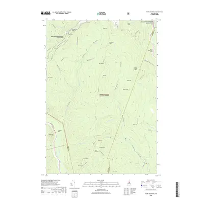
2018 Map of Stairs Mountain
USGS Topo · Published 2018About this map
The Presidential Range dominates this portion of the White Mountain National Forest, where a dense network of historic hiking corridors defines the high-altitude landscape. Highlighting the region's long history of recreational exploration, the map traces the Appalachian National Scenic Trail as it traverses ridges near Mt Eisenhower and Mt Pierce. The terrain drops sharply toward Crawford Notch, a gap carved by the Saco River and overlooked by the dramatic Frankenstein Cliff. To the east, the Mount Washington Valley provides a contrast to the high peaks, while specialized paths like the Davis Path and Edmands Path indicate the storied legacy of trail-building in the White Mountains. Notable landmarks such as Giant Stairs and Stairs Mtn sit above the Dry River drainage, marking a wilderness area characterized by steep ridges like Montalban Ridge and Rocky Branch Ridge.
Find a feature on this map
63 named features on this map. Tap any name to fly to it.
Don’t see what you’re looking for? This feature index may not catch every label — zoom into the map to look around manually.
Map Details
Editions of this 2018 Stairs Mountain Map
This is the sole edition of this map. No revisions or reprints were ever made.
Other maps of this area

1893 · Mt. Washington
USGS Topo · 1:62,500

1893 · Gorham
USGS Topo · 1:62,500

1894 · North Conway
USGS Topo · 1:62,500

1895 · Crawford Notch
USGS Topo · 1:62,500

1896 · Mt. Washington
USGS Topo · 1:62,500

1896 · Crawford Notch
USGS Topo · 1:62,500

1896 · North Conway
USGS Topo · 1:62,500

1896 · Gorham
USGS Topo · 1:62,500

1935 · Mt. Washington
USGS Topo · 1:62,500

1937 · Gorham
USGS Topo · 1:48,000