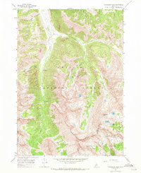
1967 Map of Standhope Peak
USGS Topo · Published 1971About this map
Standhope Peak dominates the high-altitude landscape of this 1967 survey, where the boundary between Custer and Blaine counties crosses the jagged Pioneer Mountains. The area is characterized by a dense concentration of alpine lakes, including Moose Lake, Angel Lake, and Goat Lake, which feed the drainages of Fall Creek and Wildhorse Creek. Resource extraction and recreation define the human presence here during the late 1960s. Mining activity is evident at the Wildhorse Mines and several marked Prospect sites, while the Wildhorse Campground provides a central hub for visitors accessing the high country. A network of pack trails navigates the steep terrain, particularly through Surprise Valley and the Left Fork Fall Creek, reflecting the primary method of movement through these protected reaches of the Challis and Sawtooth National Forests.
Find a feature on this map
30 named features on this map. Tap any name to fly to it.
Don’t see what you’re looking for? This feature index may not catch every label — zoom into the map to look around manually.
Map Details
Editions of this 1967 Standhope Peak Map
2 editions found
Other maps of this area

1895 · Hailey
USGS Topo · 1:125,000

1897 · Hailey
USGS Topo · 1:125,000

1935 · MacKay
USGS Topo · 1:96,000

1955 · Idaho Falls
USGS Topo · 1:250,000

1955 · Hailey
USGS Topo · 1:250,000

1958 · Idaho Falls
USGS Topo · 1:250,000

1959 · Hailey
USGS Topo · 1:250,000

1960 · Muldoon Canyon
USGS Topo · 1:62,500

1960 · Copper Basin
USGS Topo · 1:62,500

1962 · Hailey
USGS Topo · 1:250,000