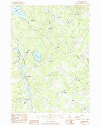
1983 Map of Standish
USGS Topo · Published 1984About this map
The Saco River defines the western corridor of this interior Maine landscape, separating Hollis from Buxton and Standish. At the time of this 1980s field check, the region was characterized by small agricultural hamlets and decentralized crossroads such as Tylers Corner, Kimbles Corner, and Groveville. Local history is anchored by numerous small cemeteries, including Flanders Cem and the prominent Meeting House Hill Cem, while the educational landscape is marked by the Bonny Eagle High Sch campus. Industrial echoes remain in the form of an Old Railroad Grade near Buxton and the site of Shaw Mills in the northeast. Natural water bodies like Watchic Pond, with its collection of named islands, and the smaller Bonny Eagle Pond provided recreational focal points amidst the wooded terrain of Oak Hill and Breakheart Hill.
Find a feature on this map
54 named features on this map. Tap any name to fly to it.
Don’t see what you’re looking for? This feature index may not catch every label — zoom into the map to look around manually.
Map Details
Editions of this 1983 Standish Map
This is the sole edition of this map. No revisions or reprints were ever made.
Other maps of this area

1891 · Portland
USGS Topo · 1:62,500

1891 · Buxton
USGS Topo · 1:62,500

1892 · Buxton
USGS Topo · 1:62,500

1893 · Portland
USGS Topo · 1:62,500

1893 · Buxton
USGS Topo · 1:62,500

1894 · Gray
USGS Topo · 1:62,500

1896 · Sebago
USGS Topo · 1:62,500

1898 · Gray
USGS Topo · 1:62,500

1914 · Portland
USGS Topo · 1:48,000

1916 · Portland
USGS Topo · 1:62,500